Klondike River: "Tramonto"

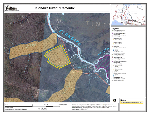
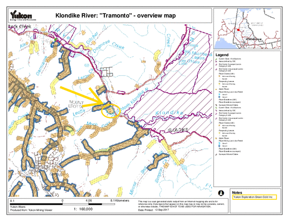
Our latest discovery of a very high gravel bank of pre-modern origin makes this medium-sized property a very interesting destination. So far we have only drilled the lower part and we during 2017 we dug few big trenches on the upper benches, with poor results. We will give a last try during 2018 and eventually drop this ground.


Status

Placer Mining Land Use Permit Class 3


Overview map Tramonto property at Klondike River

Enlarge overview map


Location and how to get there

directly along the Klondike Highway

45 km south of Dawson City


Area

235 acres


Map

115O15

overview map Tramonto property at Klondike River

Map Tramonto property at Klondike River

Kartenausschnitt vergrößern

map of Tramonto property at Klondike River